Sale Price:
$29.00
Original Price:
$39.00
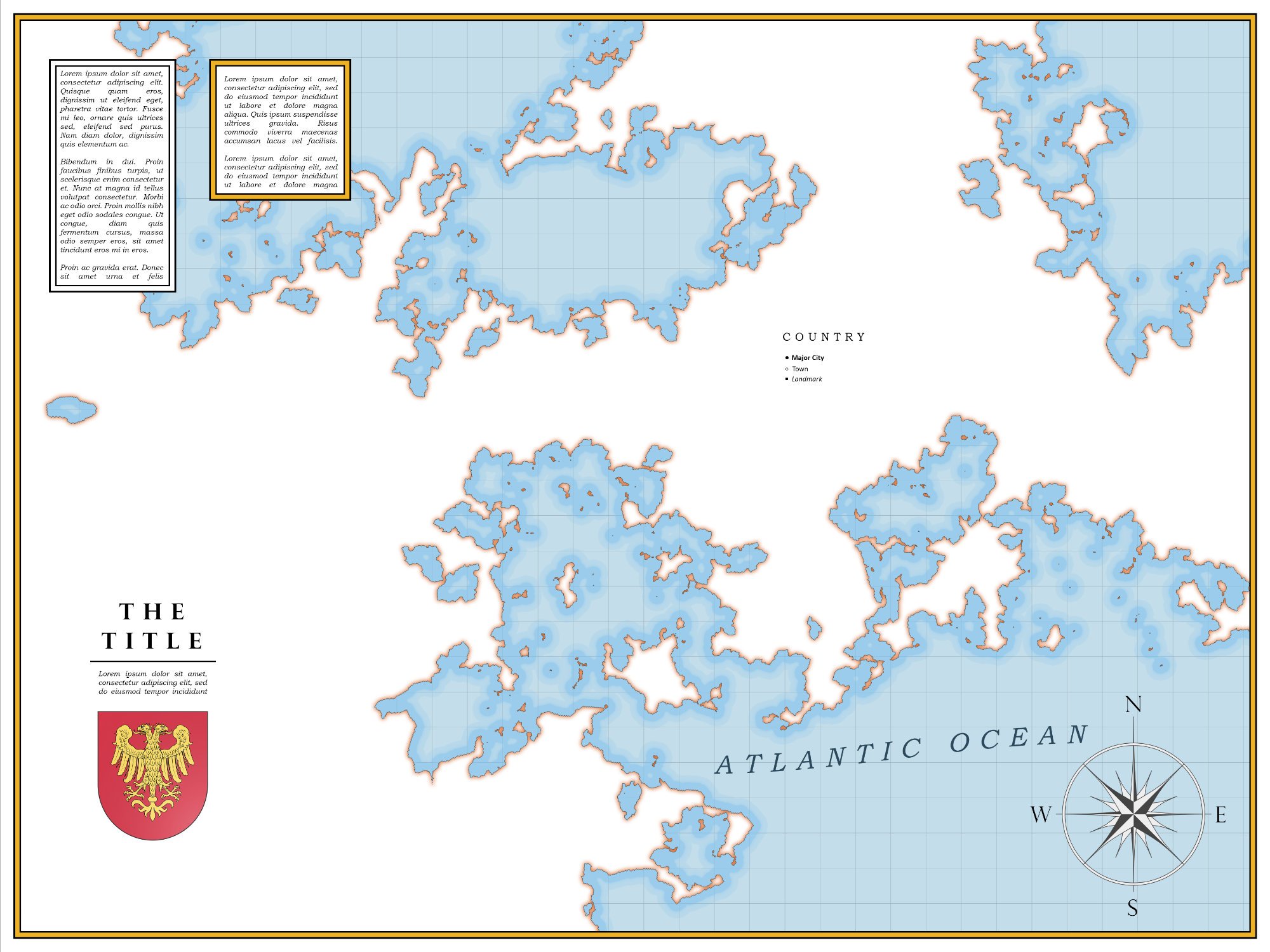
Nova Terra is a powerful, browser-based world builder that keeps your map as fluid as your imagination.
While other tools lock you into a rigid design early on, Nova Terra lets you overhaul continents, shift biomes, reroute roads, and swap styles instantly—no matter how far into the project you are. It’s a monster of a program packed with features, yet completely frictionless to modify.
Intrinsic World Scaling: Scale isn't just a static image slapped onto the canvas. It is baked directly into the map logic, automatically calculating real distances and travel times as you build.
Labels Are Places: Automatically, with fully adjustable populations biomes, settlement types, resources, perils and more.
1,200+ High-Rez Assets: Populate your kingdoms and regions with a massive library of high-resolution, professional map symbols.
Total Privacy & Offline Freedom: Runs locally in your browser. No subscriptions, no accounts, and no cloud forced upon you. Save and export massive PNGs directly to your computer.
Stop drawing rigid scenery. Start building a living, connected world.
Try the Free Demo

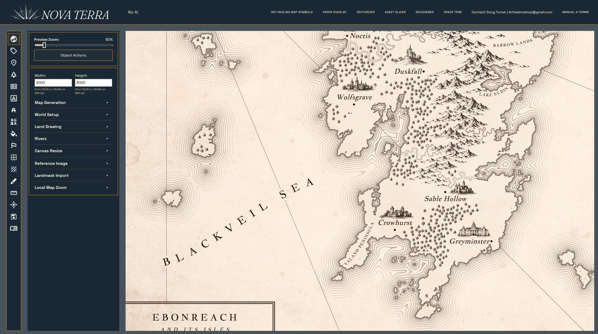 Image 1 of 23
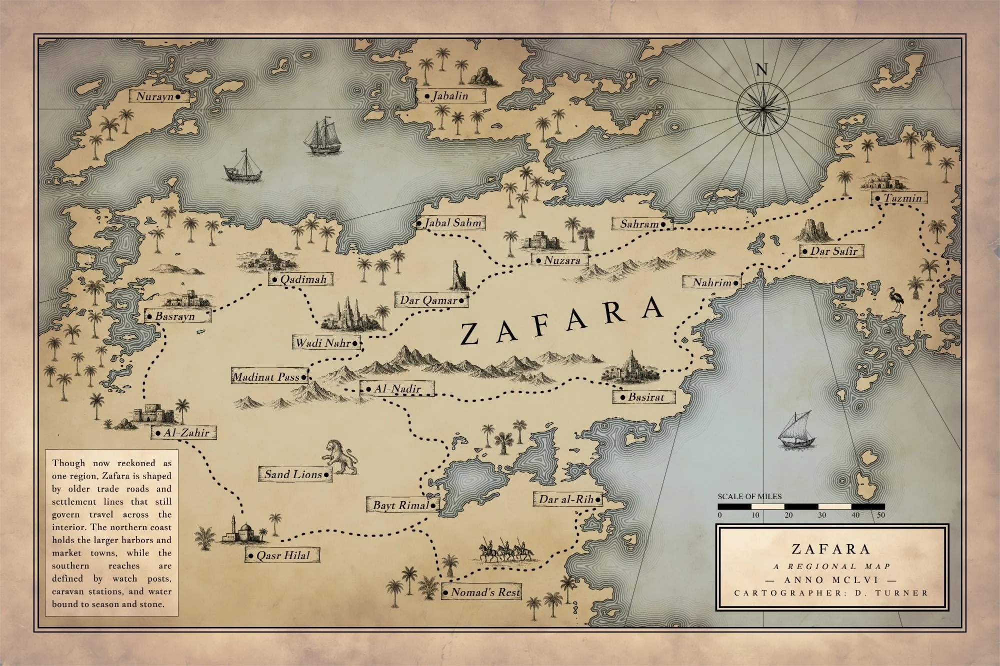 Image 2 of 23
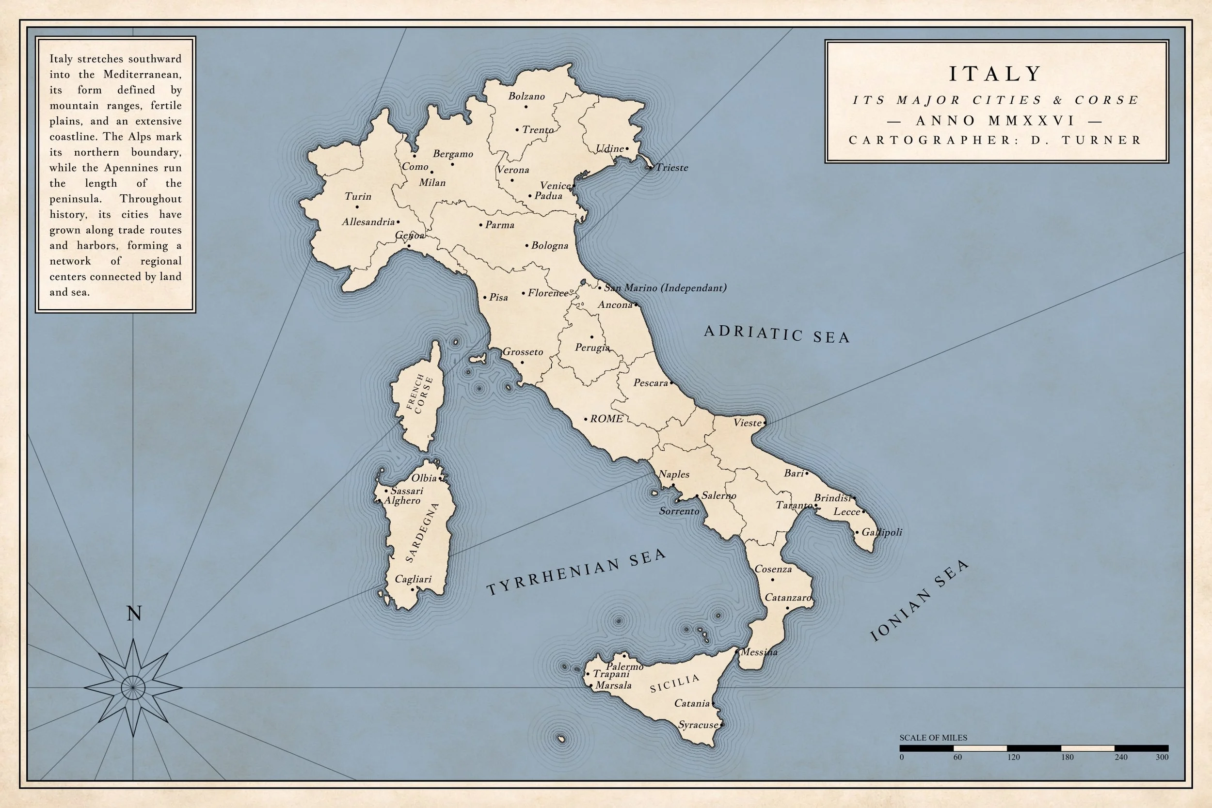 Image 3 of 23
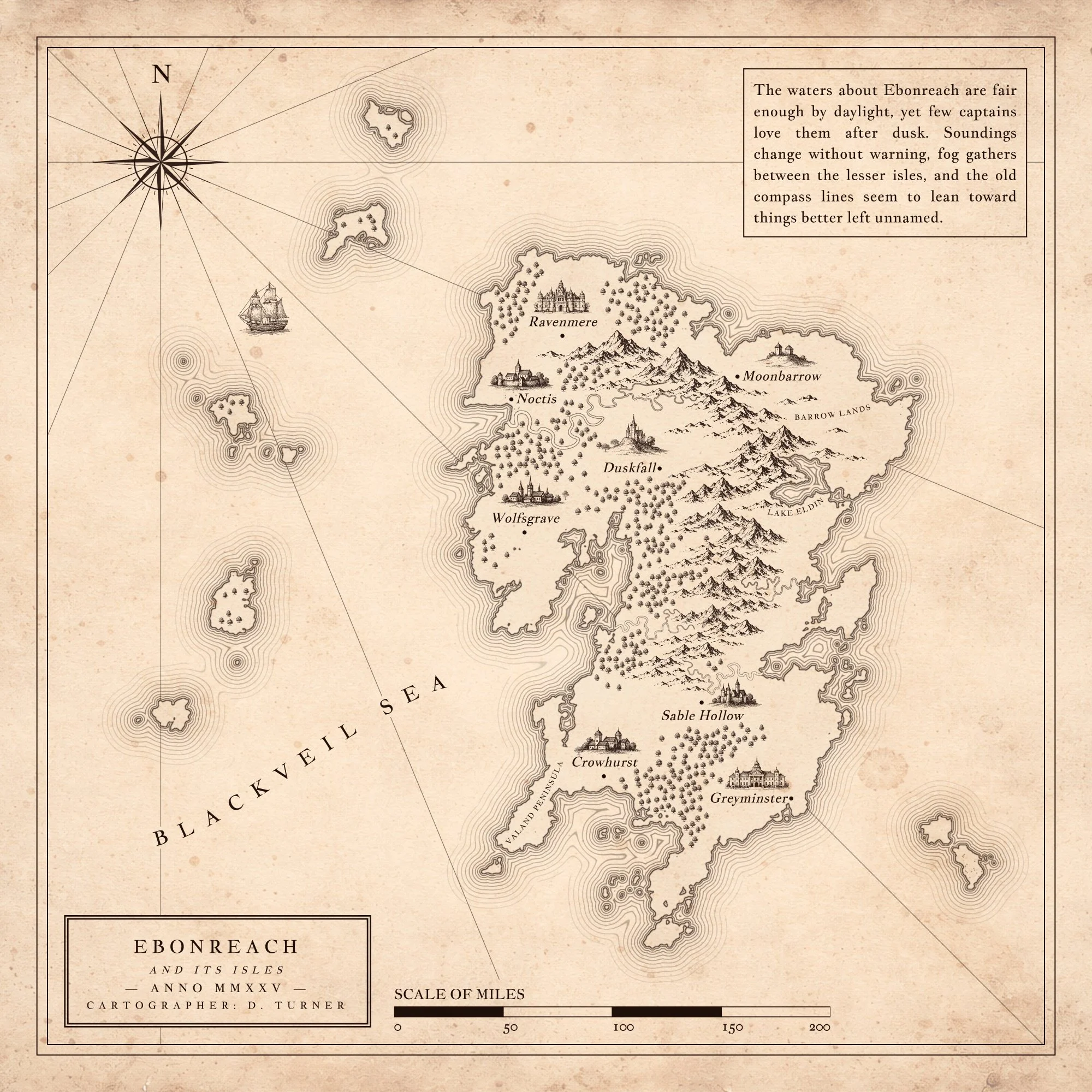 Image 4 of 23
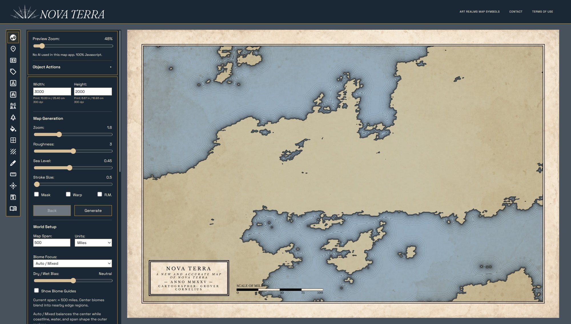 Image 5 of 23
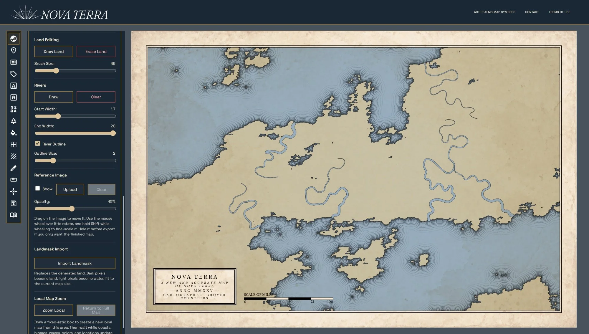 Image 6 of 23
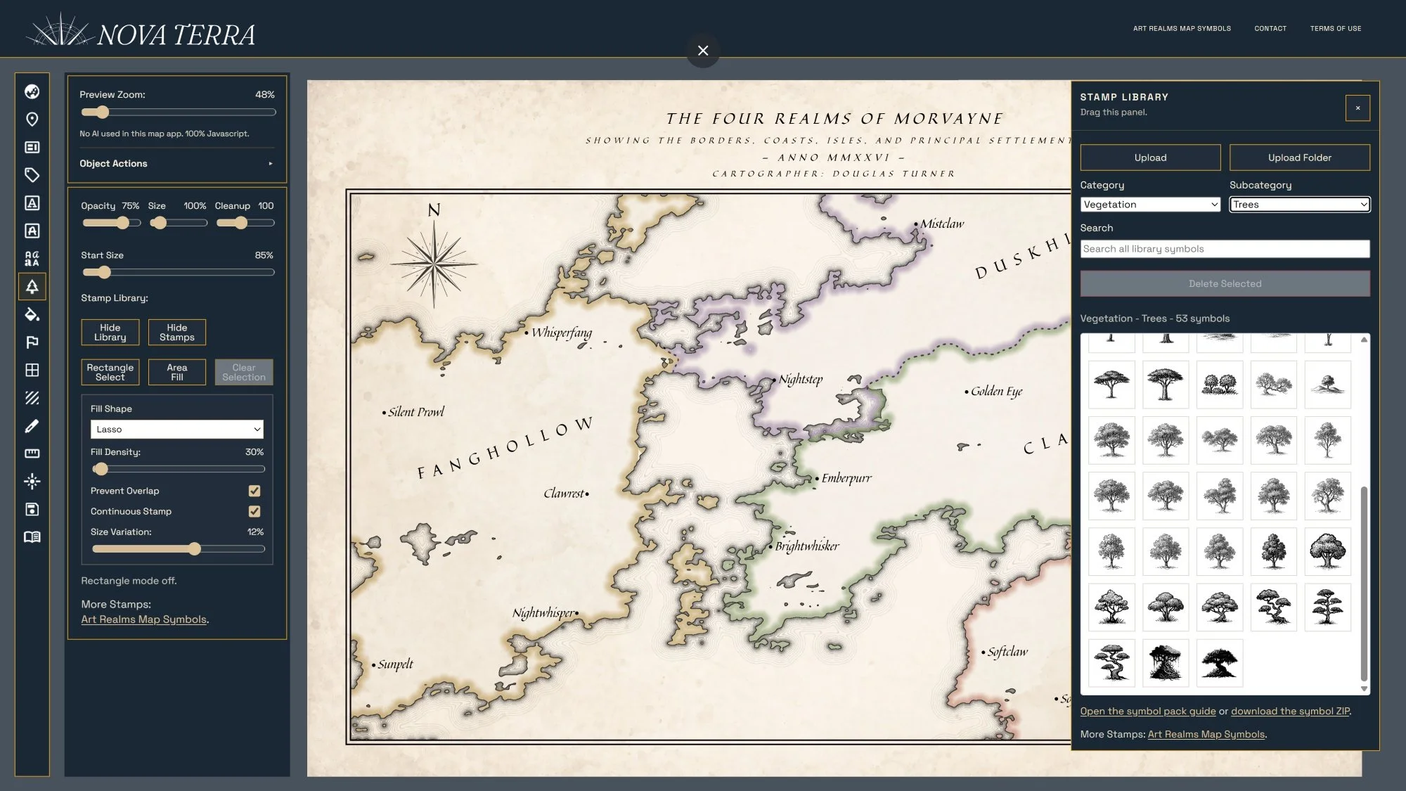 Image 7 of 23
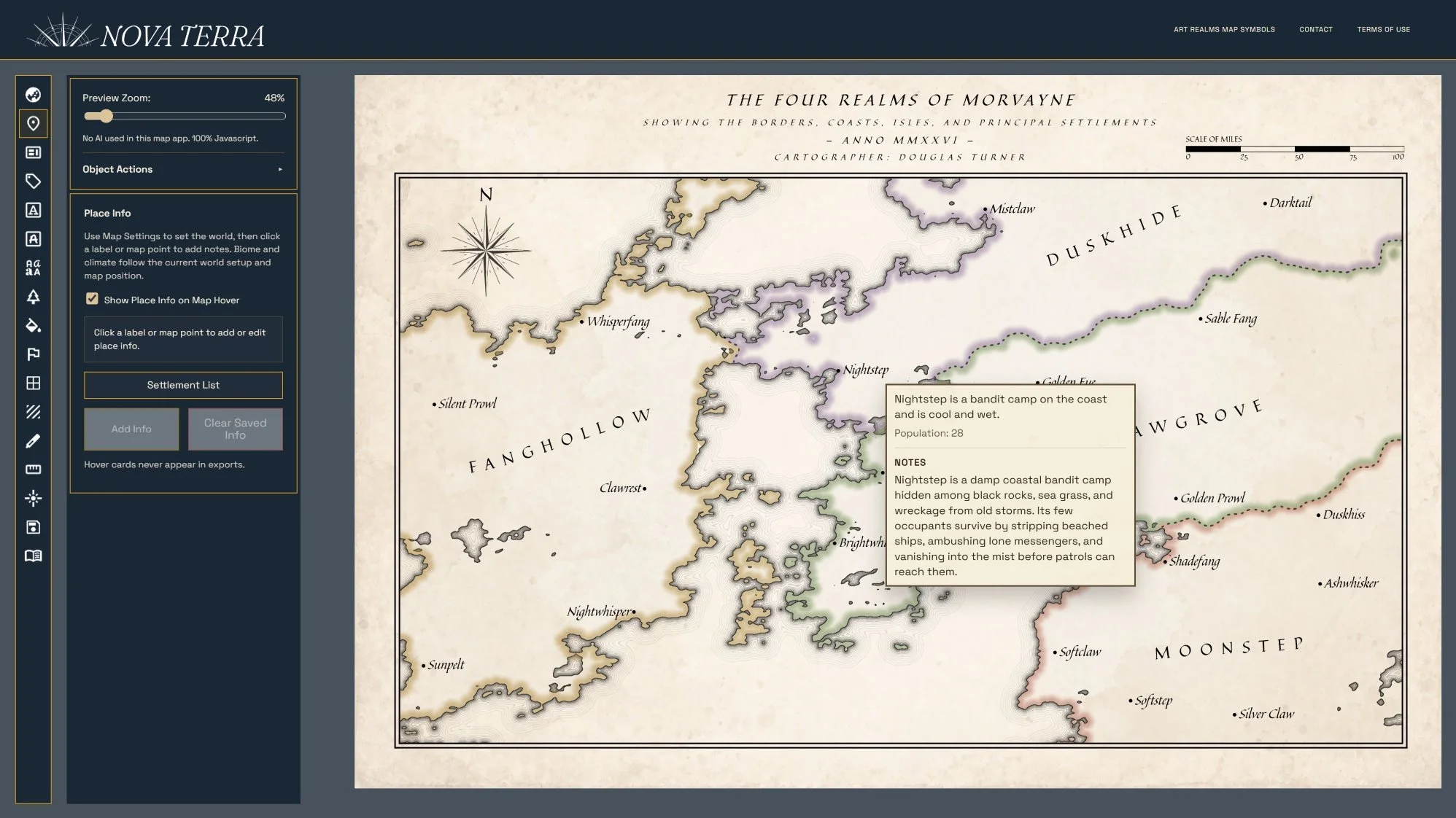 Image 8 of 23
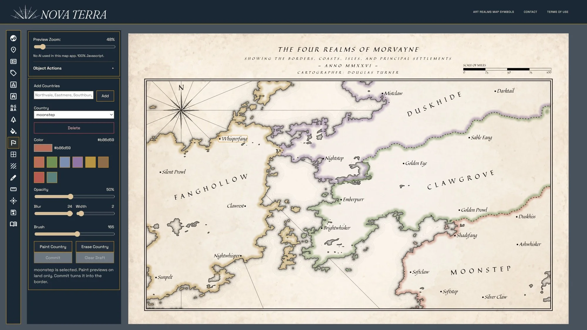 Image 9 of 23
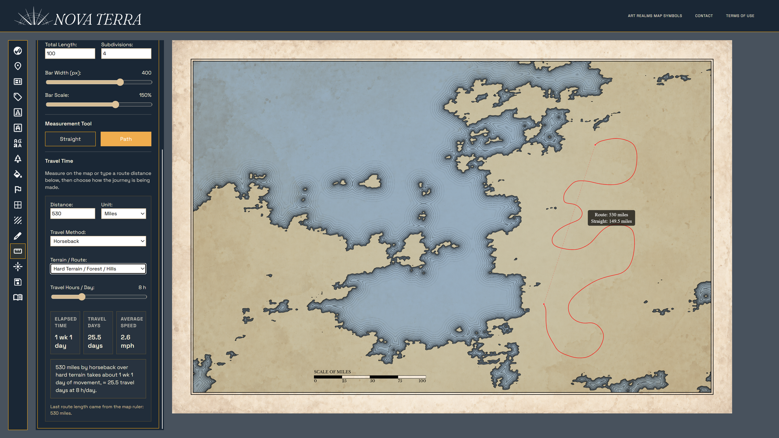 Image 10 of 23
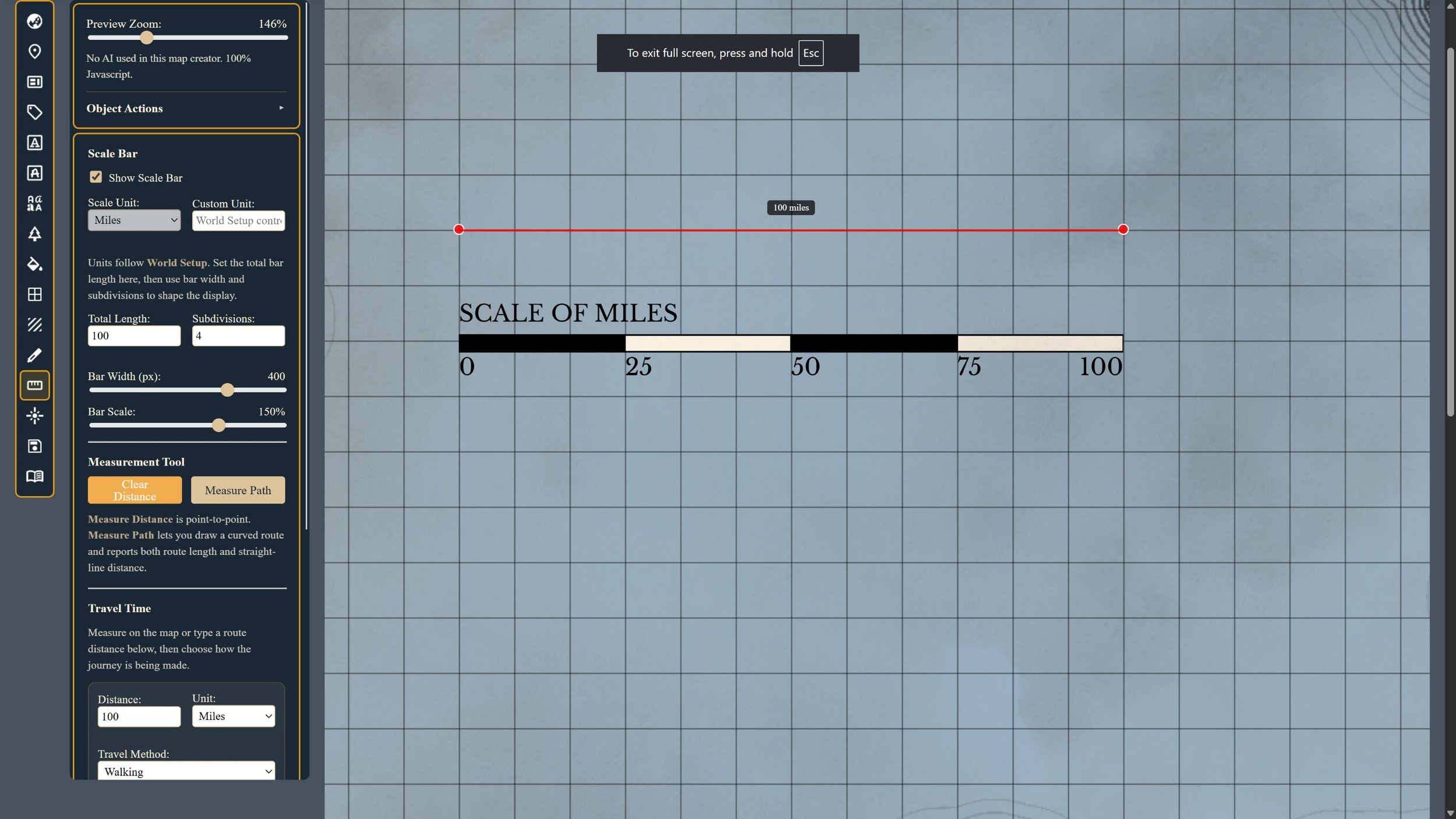 Image 11 of 23
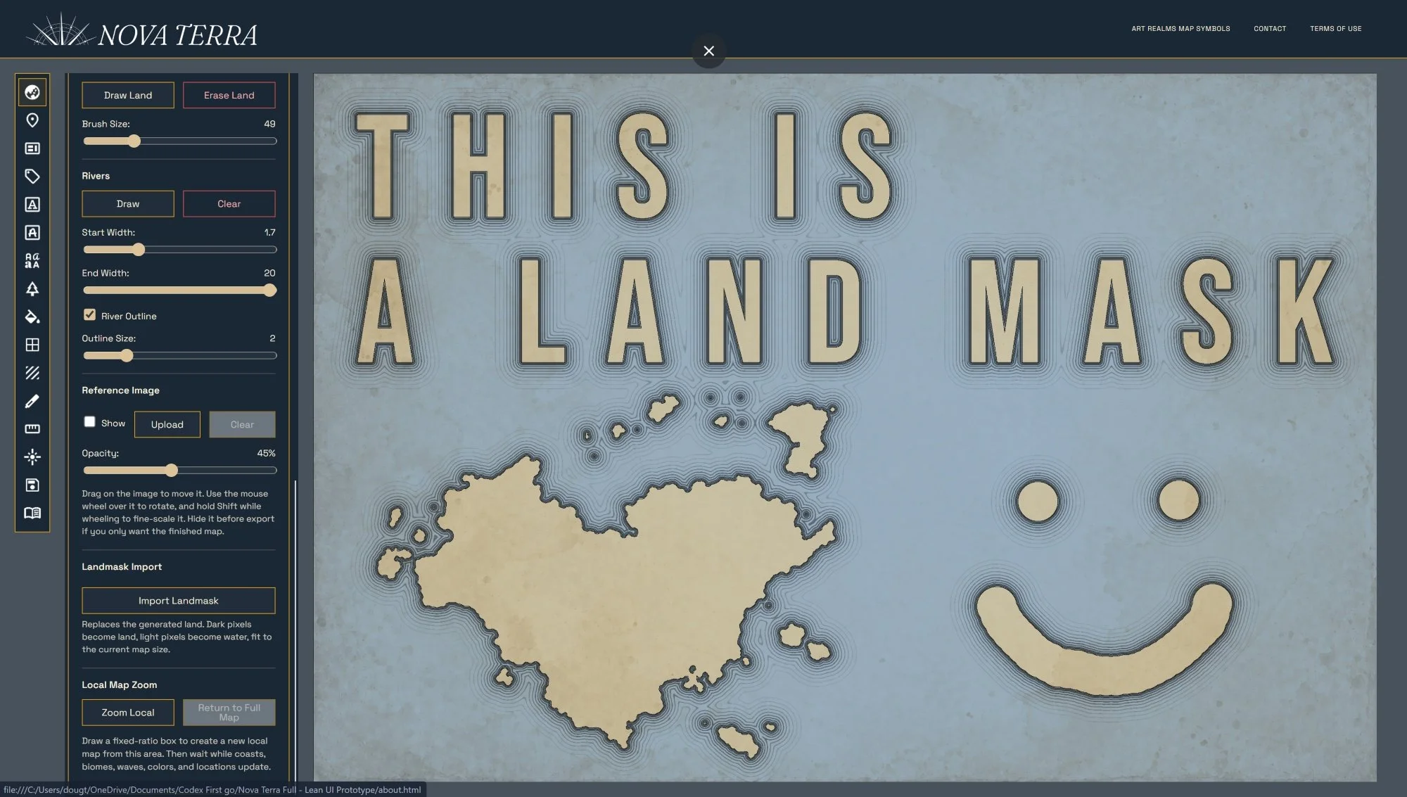 Image 12 of 23
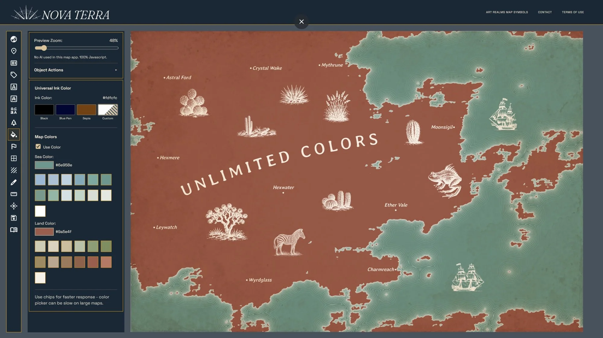 Image 13 of 23
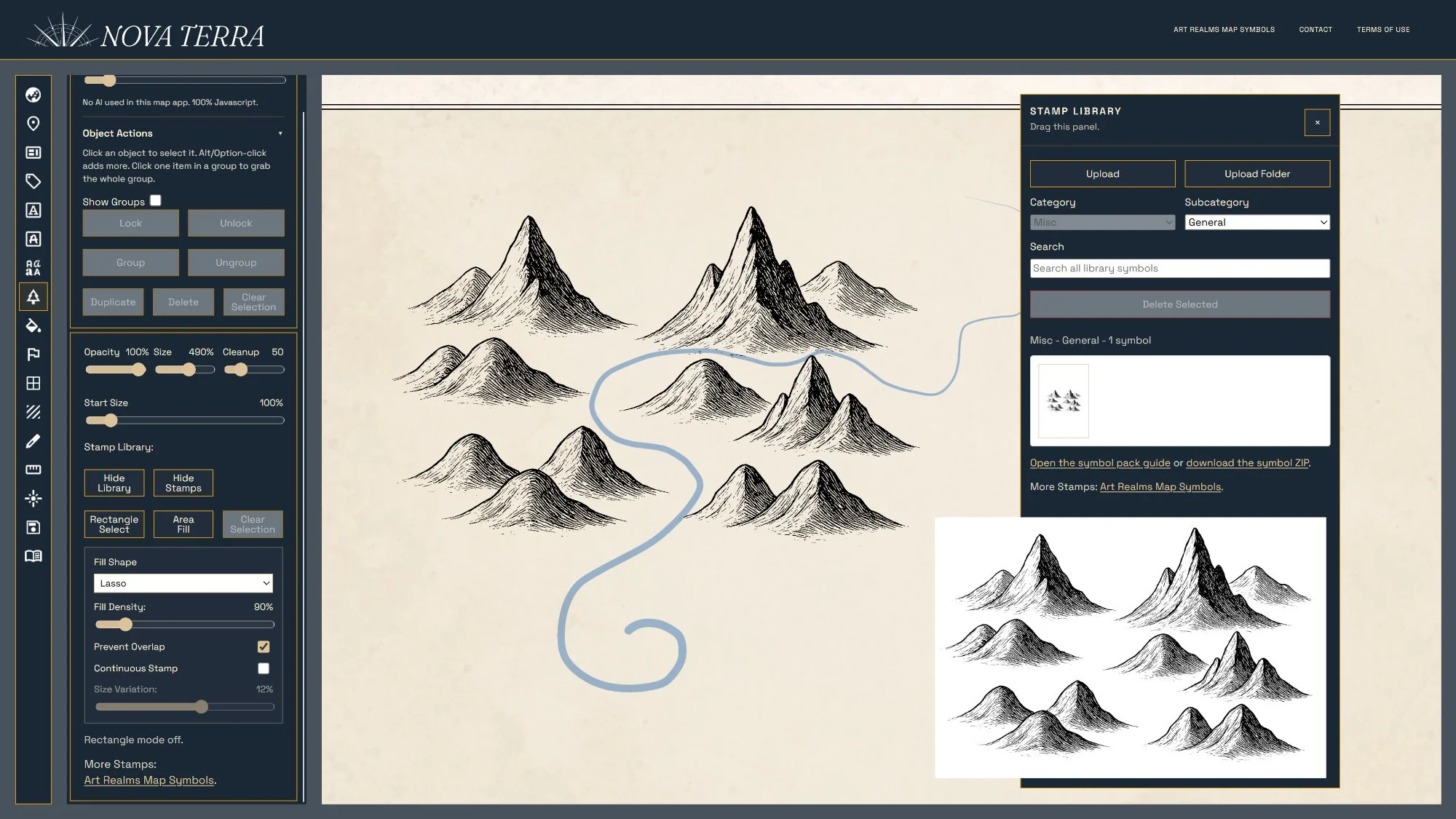 Image 14 of 23
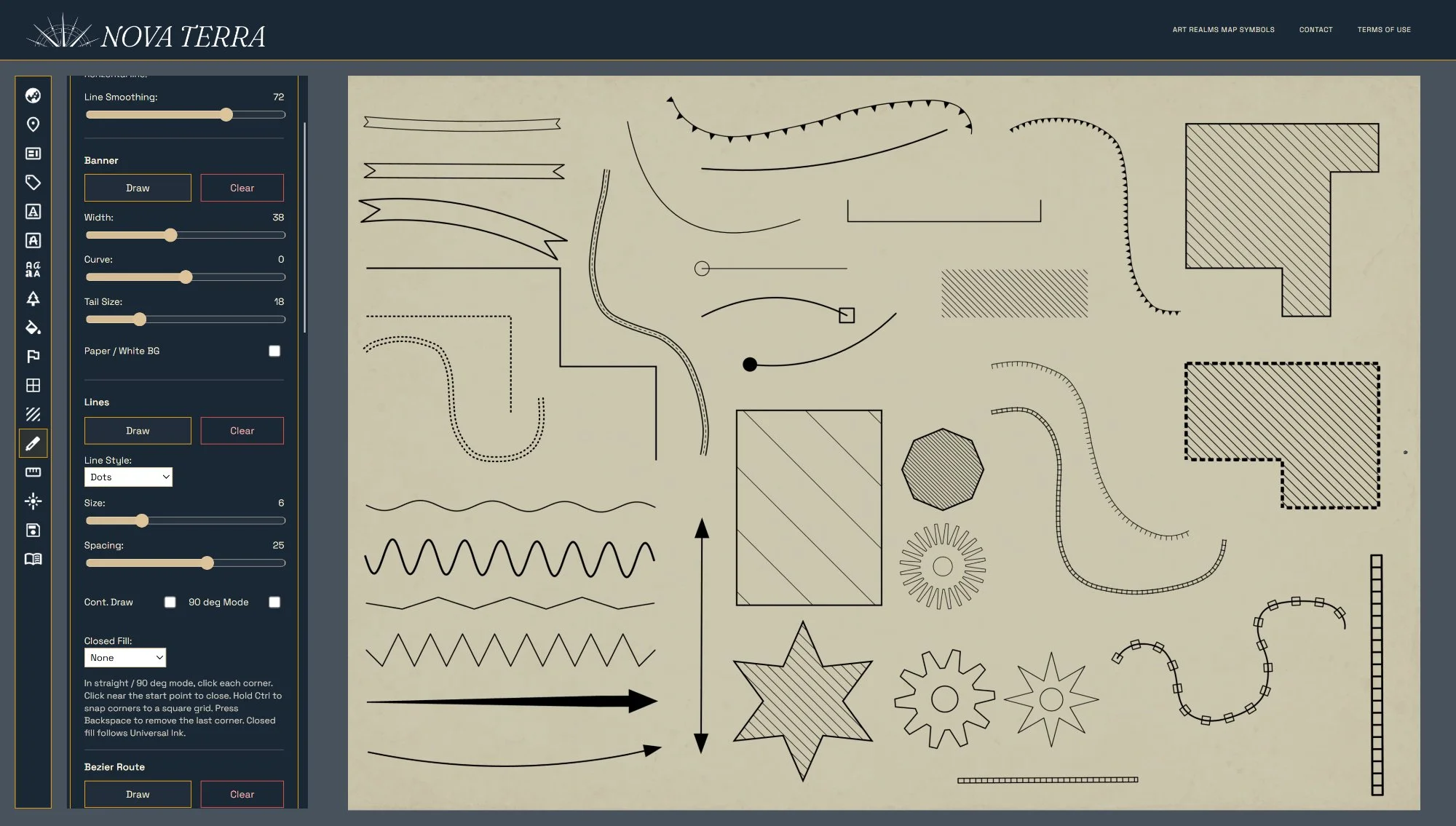 Image 15 of 23
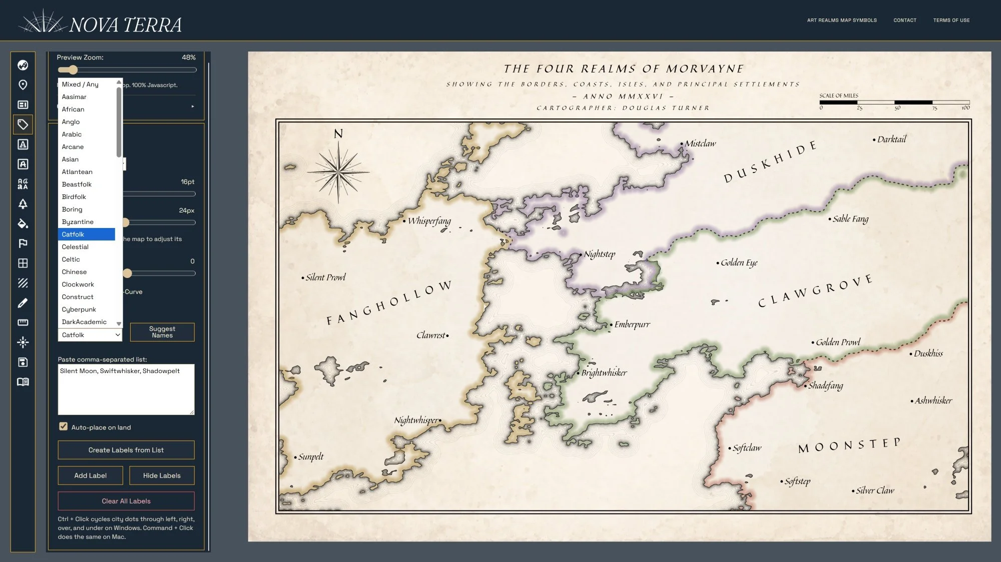 Image 16 of 23
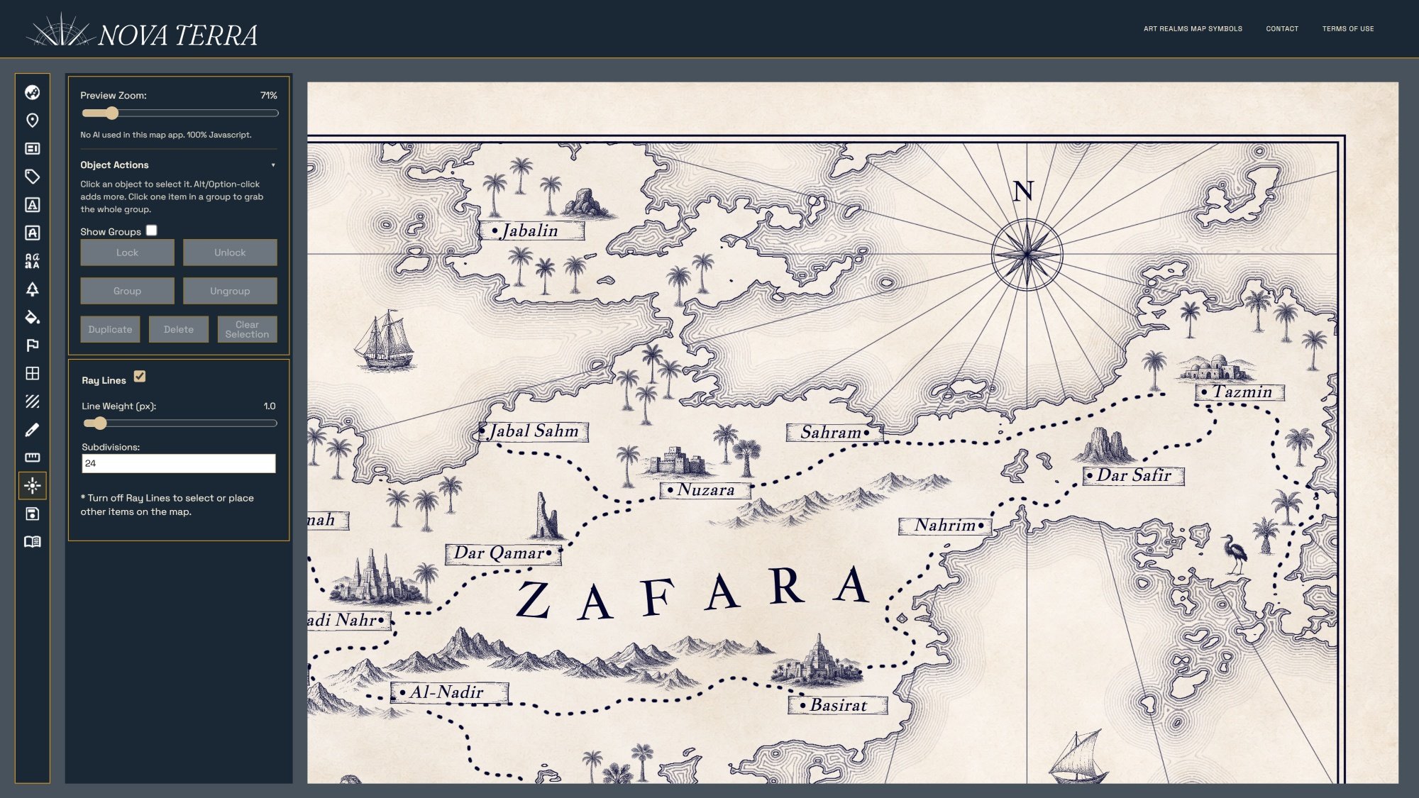 Image 17 of 23
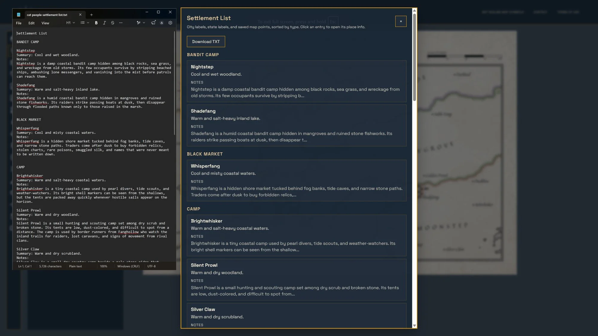 Image 18 of 23
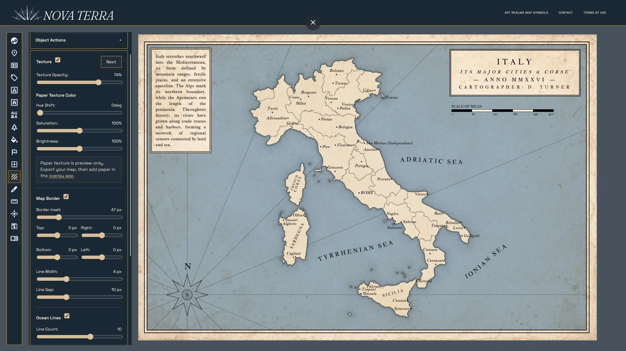 Image 19 of 23
 Image 20 of 23
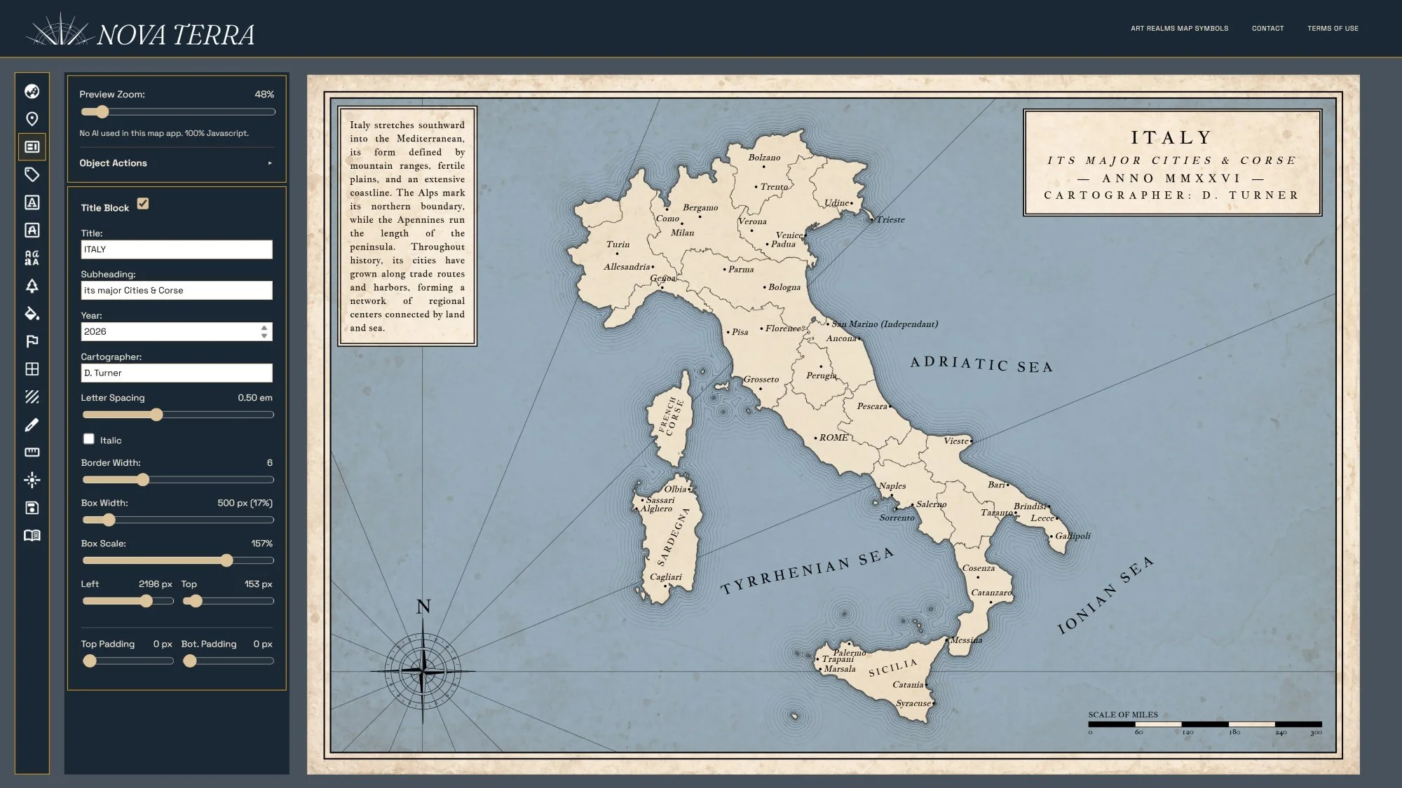 Image 21 of 23
 Image 22 of 23
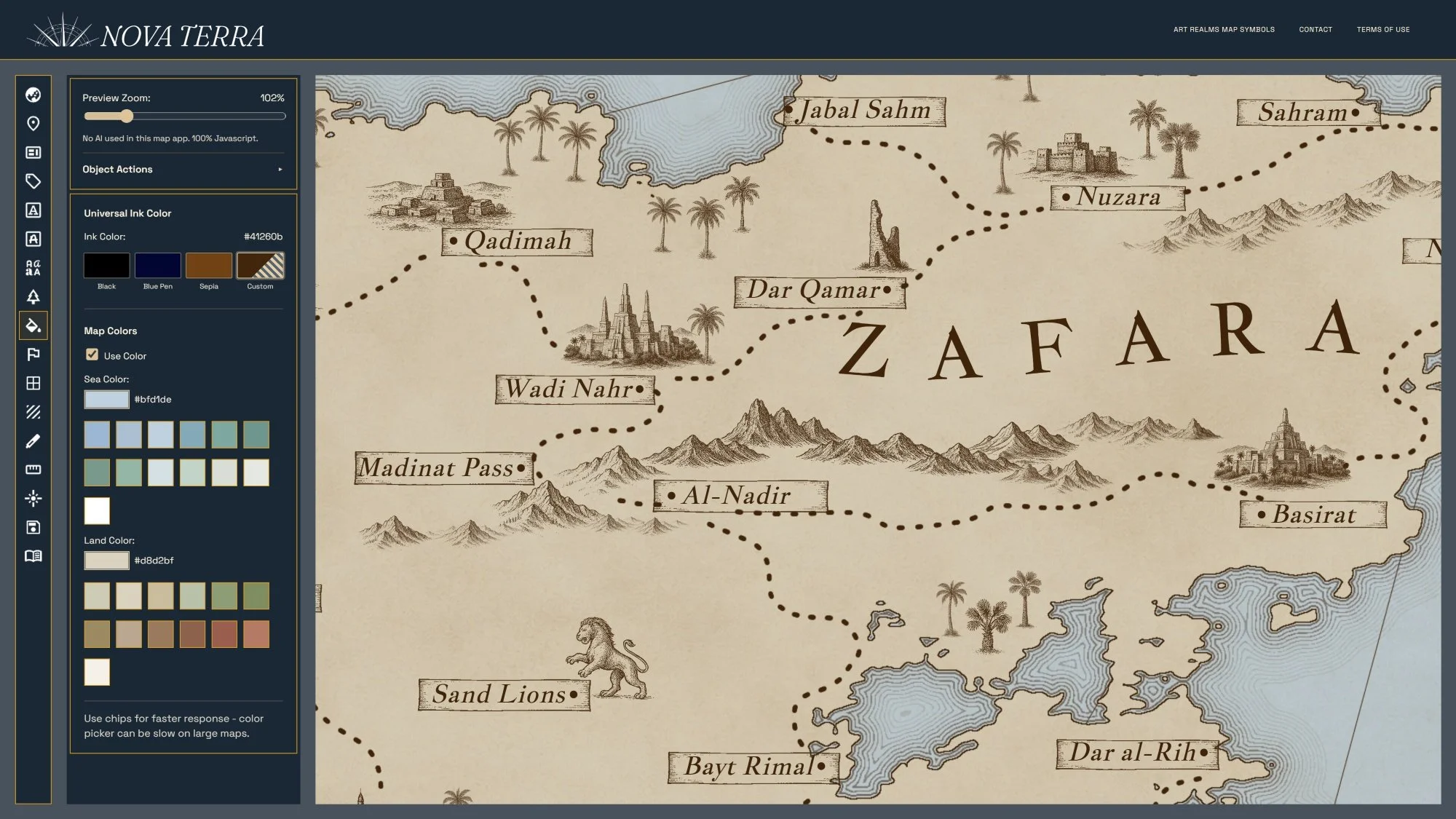 Image 23 of 23